Dalecarlia Reservoir, Bethesda, Maryland
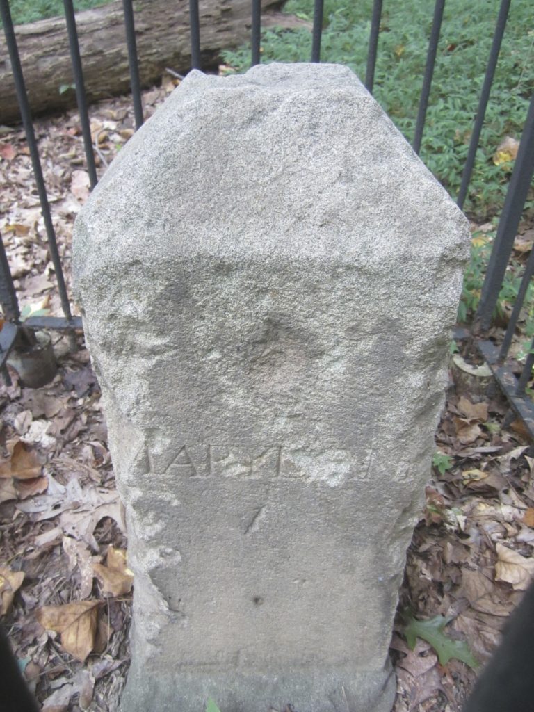
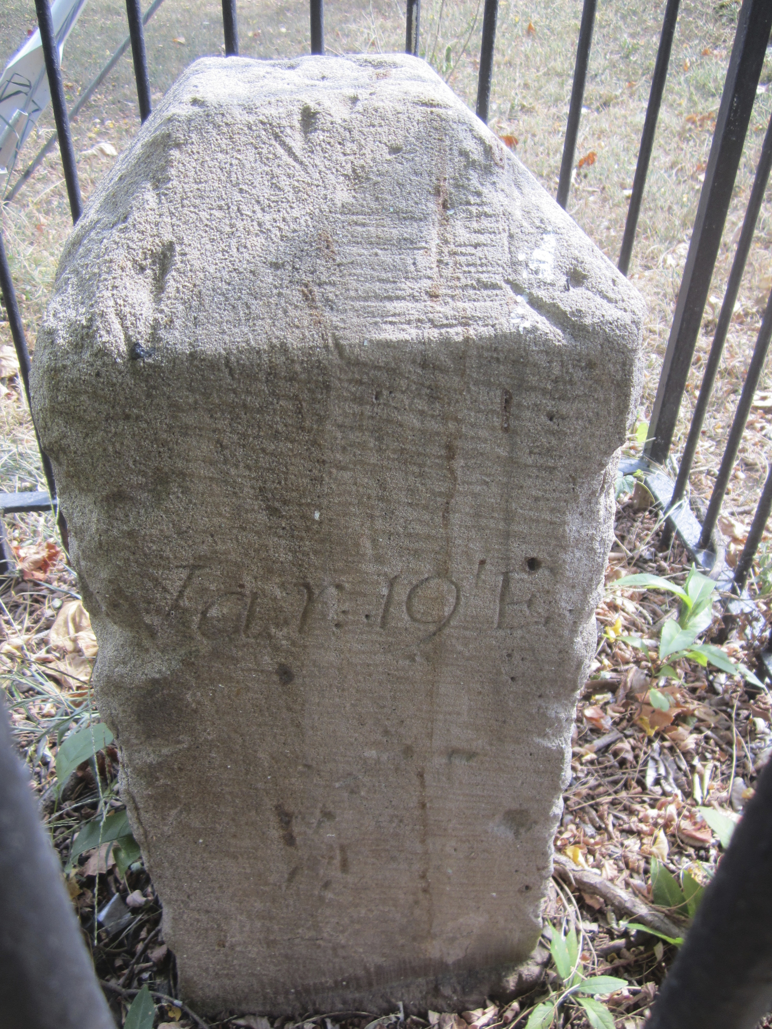
600 feet west of Dalecarlia Parkway and 300 southeast of concrete culvert, within the fenced Dalecarlia Reservoir property. From the intersection of Dalecarlia Parkway and Warren Place, walk into the forest on the west side of the Parkway. The fence around the reservoir property should be immediately visible. Follow the fence west along the northern border of the property. When the fence crosses over the creek, the concrete culvert is easily visible within the fenced area. Shortly before the crossover, there once was a person-sized hole in the fence. The stone is several hundred feet southwest of this hole and too deep into the forest to see from outside the fenced area. From the hole one could imagine reaching the stone by following an approximately straight line down the hill from the fence, across the creek (staying slightly east of the fork), and up the next hill, keeping the occasional utility markers within sight. Unfortunately, entering through the hole constitutes trespassing on federal property. Thankfully, it is possible to schedule a visit to the stone during normal business hours by calling the Dalecarlia Water Treatment Plant’s main number at (202) 764-2753.
Basic Google Maps Placemarks error: JavaScript and/or CSS files aren't loaded. If you're using do_shortcode() you need to add a filter to your theme first. See the FAQ for details.